Free 3D Globe & World Map Game
By Jangul Aslam · Published 2026-06-19
Ask most of us to point to a country on a map and we get the continent right and then start hedging. I did. My son Adiv did. So we built the thing we wished we'd had as kids: a free 3D globe you can spin with your finger, where the whole game is "find this country — go."
Globe Trek on iplay.free is a real interactive 3D globe of the Earth. It names a country, you drag the globe to spin it round, and you tap where you think that country is. Get it right and a fact card flips up — capital, region, population, neighbours. It runs straight in your browser, with no ads, no login, no download, and nothing to buy.
A real 3D globe, not a flat map
Most "world map games" hand you a flat rectangle, which quietly lies to you. On a flat map Greenland looks the size of Africa (Africa is about 14 times bigger), Antarctica smears across the whole bottom edge, and the countries near the poles balloon. You can memorise a flat map and still have a warped picture of the planet in your head.
Globe Trek uses a proper sphere. Earth is round on your screen, so sizes and distances and "which way is which" all come out the way they actually are. You spin it like you'd spin a desk globe — drag to rotate, pinch or tap to zoom, let it drift on a slow auto-spin if you just want to look. Tap a country and the globe tells you what it is.
That one difference changes how the map sticks. You stop learning "Brazil is the big one on the left-ish" and start learning where Brazil genuinely sits — which ocean is on its coast, which countries it actually borders, how far it really is from the place next to it.
Switch the layers: satellite, terrain, political
The globe isn't one fixed picture. You can flip between three ways of seeing the Earth, and each one teaches something different:
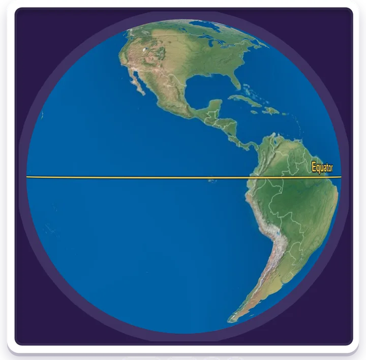
- Satellite — the planet as it looks from space: blue oceans, green forests, brown deserts, white ice. This is the default, and it's the one that makes the world feel real rather than like a diagram.
- Terrain — a relief view that shades the height of the land, so mountain ranges, plateaus and lowlands stand out. Suddenly you can see why borders and cities sit where they do — rivers, coasts, the wall of a mountain range.
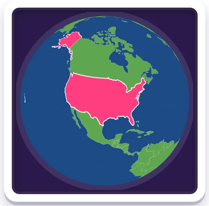
- Political — clean coloured countries with their borders drawn in, the classic classroom look, best for telling neighbours apart at a glance.
On top of any layer you can switch on reference lines — the Equator, the Prime Meridian (0°) and the Date Line (180°) — and a day-night overlay that shades the half of the Earth where it's currently night, worked out from the real position of the Sun right now. You can also mark the poles and show the axis the Earth spins around. None of it is decoration: it's the scaffolding that makes latitude, longitude, time zones and seasons click instead of staying as words in a textbook.
How you actually play
It's a game, not an atlas you stare at. A round is short and the loop is simple:
- The globe shows you a country to find — by name, with its flag on the find-pill.
- Drag to spin the Earth round until you've got the right region in front of you. Zoom in if you need a closer look.
- Tap the country. Right answer: it lights up and a fact card appears (capital, region, population, area, who it borders).
- Wrong tap? The country you actually hit lights up in a different colour with its name and flag — so even a miss teaches you the map — and you get another go.
There are three difficulties. Easy sticks to the big, famous nations; Medium widens the net; Hard is all 194 UN member countries, including the small ones you have to hunt for. If you're stuck, gentle hints walk you in — region, then sub-region, then capital, then a spin straight to it — or you can ask it to reveal the answer. Use them or ignore them; the choice is yours.
Pair it with the flags
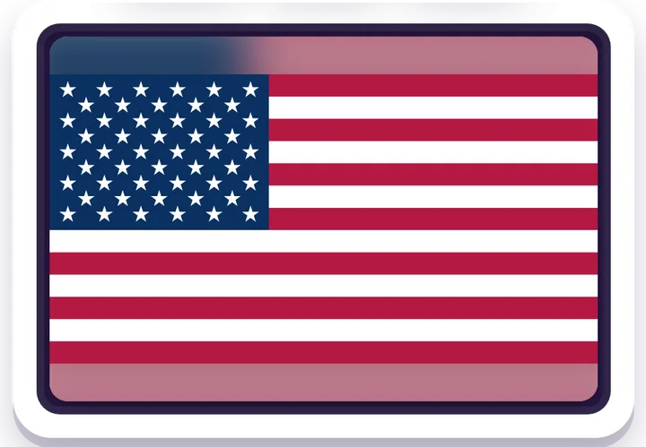
Knowing where a country is and knowing its flag are two different muscles, and they reinforce each other. Our flag game is the natural companion:
- Flag Guess — see a flag, name the country. It's the fastest cure we've found for mixing up one red-white-and-blue flag with another. Learn the flag in Flag Guess, then find the country on Globe Trek, and it tends to stay learned.
Both games live in our geography games hub, and both share the same hand-checked dataset of 194 countries — so the capital you see on the globe is the same one you'll meet in the flag game.
A globe that earns its place during the World Cup
We built the geography games partly because the 2026 World Cup lit a fire under us — 48 teams walking out behind 48 flags, and us realising we couldn't place half of them. Spinning between the three host countries (the United States, Canada and Mexico) and the qualified nations on a globe is how it finally stuck.
If you're following the tournament, two more games make the connection explicit:
- Soccer Globe Hunt — the same 3D globe, but now you're finding the host nations of past World Cups. Where was 1950 played? Where is 2026? Spin and tap.
- Soccer Cup Quest — the all-rounder quiz on hosts, champions, scores and top scorers, working back through the tournament's history.
Those sit in the sports games hub, and there's a fuller write-up in our post on free World Cup soccer games. The globe is the bridge between the two: learn the world, then learn the football that travels across it.
Quick answers about the 3D globe game
Is the globe game really free? Yes — completely free, with no ads, no login, no download, and nothing to buy. Globe Trek opens in any browser on a phone, tablet, or computer.
What's the difference between this and a flat world map game? Globe Trek is a real 3D sphere, so country sizes, distances and directions are accurate — flat maps stretch and distort the land near the poles, giving you a warped picture of the world.
Can I switch between satellite and political views? Yes. You can flip between satellite, terrain and political layers, plus optional Equator/Meridian/Date-Line lines and a live day-night overlay.
What age is it good for? Roughly age 7 and up, with three difficulty levels. Easy covers famous nations; Hard covers all 194 UN member countries. It's a genuine geography workout for grown-ups too.
How do you play it? The globe names a country; you spin the Earth, then tap where it is. Correct taps flip up a fact card with the capital, region and population; wrong taps show you what you hit, so you learn either way.
Why it's free, and good for the whole family
Everything on iplay.free is free, with no ads, no sign-up, no download, and nothing to buy — it just opens in any browser. The games run in 11 languages, and there's nothing to mistap into, nothing collected, and nothing that needs a grown-up's password.
A spinning globe is the rare bit of screen time that quietly builds something real: a map of the world that lives in your kid's head, not just on a wall. That was the whole point. Adiv and I wanted a globe we could spin and learn from — so we made one, and left it open for everyone.
— Jangul & Adiv